Historical Map of Tudor London, C.1520

Historical Map of Tudor London, C.1520 A Detailed Street Map Of...

Sheet Map (10 Apr 2013)

Not available for sale

Includes delivery to the United States

Out of stock

This service is protected by reCAPTCHA and the Google Privacy Policy and Terms of Service apply.

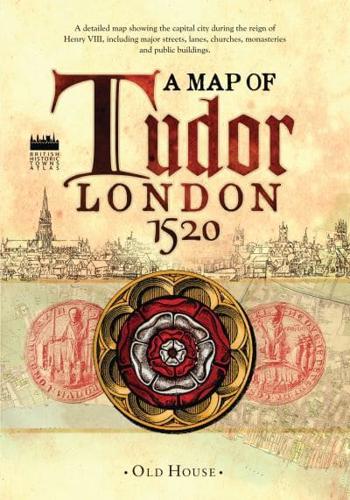
Publisher's Synopsis

The capital city during the reign of Henry VIII around 1520, showing major streets, lanes, churches, great houses, monasteries and public buildings. This map reveals medieval London at its most impressive, before the city was overwhelmed by a massive population explosion.

Book information

ISBN: 9781908402516
Publisher: Bloomsbury Publishing (UK)
Imprint: Old House Books
Pub date:
Language: English
Weight: 116g
Height: 211mm
Width: 150mm
Spine width: 7mm