

Publisher's Synopsis
Explore Ireland's fascinating story with more than 100 maps.
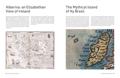
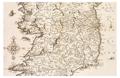
From the early history of the Emerald Isle to the modern day, Ireland has evolved rapidly - along with the ways in which it has been mapped. Cartography has not only kept pace with these changes, but often driven them.
Combining the artistic world of early cartography with modern computerised surveys, this is a beautiful and unique addition to any map- or history-lover's collection. Irish author and historian Pat Liddy produces an invaluable history of Ireland and its relationship with its neighbours, and indeed, the world.
Featured maps include:
- Ptolemaic Map of Ibernia, 15th century
- Mercator's Irlandiae Regnum, c. 1560
- Battle of Kinsale, 1601
- John Speed's Map of Ireland, 1610
- Down Survey, 1683
- Siege of Londonderry, 1689
- Survey of Dublin Bay, 1800
- INFOMAR's Map of the Seabed, 2019
Other books in the Collins History in Maps series:
- History of War in Maps by Philip Parker (ISBN 9780008506490)
- History of World Trade in Maps by Philip Parker (ISBN 9780008409296)