


Publisher's Synopsis
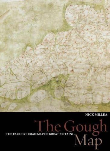
For centuries, the Gough Map, one of the Bodleian Library's greatest treasures, has impressed viewers with its remarkable detail and baffled historians with its hidden secrets: who made it and why was it made? Recent digitization of the map is helping to provide answers to these questions, and is making the map more legible than at any other time since its arrival in the Bodleian in 1809. This process has also made it possible to project a modern map of Britain over the Gough Map (georectification), demonstrating the remarkable accuracy of much of this 700 year-old route map. Here, in stunning detail are the principal medieval settlements of Great Britain, from Bristol, through Oxford, and over to Norwich; the Severn, Thames, and Humber rivers, and even the loop of the Wear at Durham; Scotland, assuming an unfamiliar shape; the routes between towns, marked in red with distances included in Roman numerals; and even a single tree, identifying the New Forest. This beautifully illustrated book contains not only a pull-out print of the map but also many close-up images of each area, providing an unparalleled opportunity to view this spectacular and engaging survival from medieval map-making.