Publisher's Synopsis
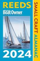
Reeds Nautical Almanacis the indispensable annual compendium ofnavigational data for yachtsmen, and provides all the informationrequired to navigate Atlantic coastalwaters around the whole of the UK, Ireland, Channel Islands and the entireEuropean coastline from the tip of Denmark right down to Gibraltar, Northern Morocco andthe Azores.
The 2010 edition continues the Almanac's tradition of year on yearimprovement and meticulous presentation of all the data required forsafe navigation. Now with an improved layout for easier reference andwith over 45,000 annual changes, it is regarded as the bible of almanacs foranyone going to sea.
Includes: 700 chartlets, Harbour facilities, Tide tables andstreams, 7500 waypoints, International codes and flags, Weather,Distance tables, Passage advice, Area planning charts, Rules of theroad, Radio information, Communications, Safety, Documentation andCustoms.
Includes a free Reeds Marina Guide. Free supplements ofup to date navigation changes are available from January to July from www.reedsalmanac.co.uk.
"There are some things I would not go to sea without - Reedsis one of them" Sir Chay Blyth
"The big, bold, extravagantly comprehensive king of Almanacs" Yachting World
"The bible of almanacs" Classic Boat