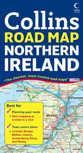
Publisher's Synopsis
Scale: 4.9 miles to 1 inch 1:310,000.This clear, colourful road map has been fully updated for this edition. Includes tourist information along with a comprehensive range of settlements. There is also a range of town centre plans.MAIN FEATURESThis clear, detailed road map of Northern Ireland at a scale of 4.9 miles to 1 inch is ideal for touring and route planning. There are fully indexed town and city centre street plans of Belfast, Bangor, Lisburn, Londonderry and Newry.INCLUDES• Places of tourist interest.• Colour classified roads.• Distances between towns.• Railways and stations.AREA OF COVERAGECovers the whole of Northern Ireland plus Donegal.WHO THE PRODUCT IS OF INTEREST TOThe clear, detailed mapping make this an ideal purchase for both residents and visitors.