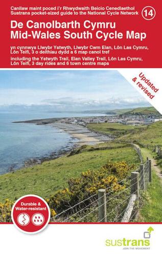
Publisher's Synopsis
The sparsely populated areas of mid-Wales provide an ideal location for an adventure if you want to get away from the crowds. The coastal areas that surround Cardigan Bay offer great views out to sea, whilst the counties of Ceredigion and Powys afford some challenging gradients as well as a selection of wonderful traffic-free paths. This revised map to mid-Wales south is in the series of pocket sized, folded maps to the National Cycle Network which include clearly mapped on-road and traffic-free paths, easy to read contours and detailed town insets. 1:110,000 scale; folded 155mm x 99mm; flat 792mm x 630mm. The Mid-Wales South Cycle Map includes the Ystwyth Trail, Elan Valley Trail, Lon Las Cymru, Lon Teifi, 3 day rides & 6 town centre maps and is now printed on durable, waterproof paper.