
Publisher's Synopsis
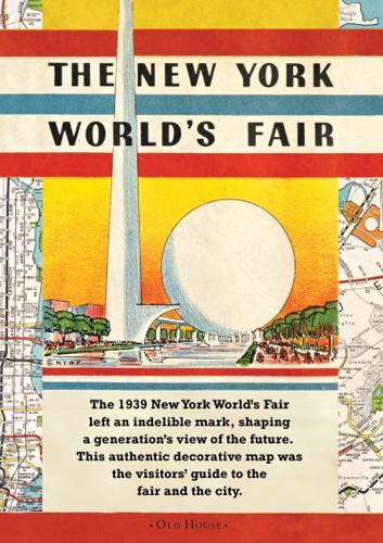
The New York World's Fair 1939 was a genuinely historic event that was attended by 44 million people and shaped generations' views of the world's greatest city. This is the a beautiful reproduction of the original souvenir map that was produced for the occasion. Before the first schematic was introduced in the 1930s and widely adopted in later decades, maps were art objects, windows on the world that helped the armchair-traveller imagine far-away places in an age before TV. This unique double-sided map of the New York World's Fair in 1939 is a detailed guide to transportation in all five boroughs and is illustrated to note "High Spots" that every visitor should see, like the Empire State Building, The Museum of Natural History and the theatre district, alongside legendary and now long-gone Ebbets Field baseball field and Roosevelt Field Air Field (where Charles Lindburgh took off). It also includes fascinating contemporary details such as hotel advertisements at the 1939 price of $7 a night.


