
Publisher's Synopsis
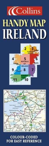
Scale: 10 miles to 1 inch 1:633,600. This route planning map is extremely easy to use, and has lamination on both sides making it very hard wearing. Updated for 2005.MAIN FEATURESThis durable laminated map opens almost like a book, giving it the convenience of an atlas with all the benefits of a fold out map. It features clear full colour mapping at 10 miles to 1 inch and city centre plans of Belfast & Dublin.INCLUDES• Distance chart on back of map• Roads colour classified• Areas of tourist interest, plus Tourist Information Centres and offices shownAREA OF COVERAGECovers the whole of the Republic of Ireland plus Northern Ireland.WHO THE PRODUCT IS OF INTEREST TOAnyone who would like a durable, handy format, route planning map of the whole of Ireland, from tourist to business user.


