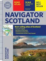
Publisher's Synopsis
This best-selling A4 format has a large scale of 3.2 miles to 1 inch, and has a luxurious leather binding. Each page has been titled with its geographical location so you can turn to the page you need more easily. Static speed camera locations with speed limits are pinpointed. Wide minor roads, National Trust, English and World Heritage sites, crematorium locations, and other hard-to-find places are also shown. There are 107 city, town, and port plans, plus fully indexed central London street maps. A comprehensive 31,500 index with airports, top tourist sites and motorway services listed. Plus, scenic routes, tourist sites with satnav friendly postcodes, and caravan and camping sites symbolized on the mapping. The paper in this atlas is produced from environmentally sustainable resources.


