Delivery included to Ireland

10% OFF Enter TENOFF at the basket

Offer expires Friday 6th June 2025 Terms and Conditions apply

Dorset A-Z County Atlas

Dorset A-Z County Atlas

New Third edition

Spiral / Comb Bound (15 Jun 2017)

Not available for sale

Out of stock

This service is protected by reCAPTCHA and the Google Privacy Policy and Terms of Service apply.

Publisher's Synopsis

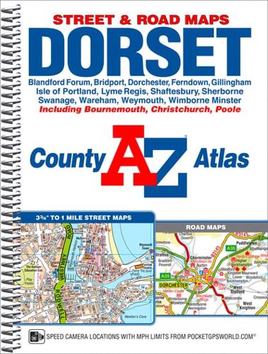
This spiral bound map of Dorset includes 118 pages of street mapping covering major towns and villages in the county, including:•Blandford ForumBournemouthBridportChristchurchDorchesterFerndownGillinghamIsle of PortlandLyme RegisPooleShaftesburySherborneSwanageWarehamWeymouthWimborne MinsterIn addition there are large scale town centre maps of Bournemouth and Poole and 9 pages of road mapping which covers the whole of the county.Postcode districts, one-way streets and safety camera locations with speeds are featured on the street mapping.The index section lists streets; selected flats, walkways and places of interest; place and area names and National Rail stations. Hospitals and hospices covered by this atlas are listed separately.

About the Publisher

Geographers' A-Z Map Co Ltd

Started in 1936 as Geographers' Map Company Ltd, we are now the largest independent map publishing company in the UK, producing iconic products such as the London A-Z. We produce over 340 mapping products and employ 80 staff, many of whom joined from school, and have been with the Company for over 25 years. Our founder, Phyllis Pearsall MBE, gave us a motto- "ON WE GO" and as a team we can, and will, do just that, providing high quality mapping products and priding ourselves on customer satisfaction.

Book information

ISBN: 9781782571896
Publisher: HarperCollins Publishers
Imprint: Geographers' A-Z Map Co Ltd
Pub date:
Edition: New Third edition
Language: English
Number of pages: 168
Weight: 372g
Height: 188mm
Width: 246mm
Spine width: 15mm