Publisher's Synopsis
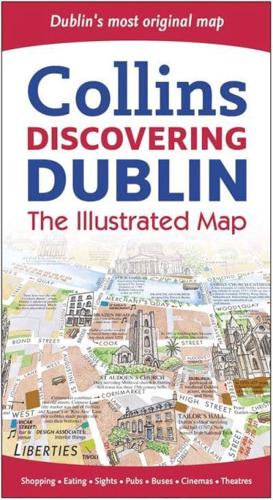
The most original map of Dublin - delightful water-colour mapping and large scale plans of the city centre, shopping and entertainment areas.Winner of IMTA Best Map Award 2012 Silver Award Best Folded MapScale 1:6000/11 inches to 1 mile.MAIN FEATURESThis product displays delightful water-colour mapping, with individual paintings of all the main sights and landmarks in Dublin. It includes extra large scale maps of the Temple Bar and Grafton Street areas plus Powerscourt Townhouse Centre, Westbury Mall and St Stephen's Green Centre with snippets of information on all the shops and restaurants to be found there.INCLUDESComprehensive index.Car parks, one-way streets, taxi ranks and bus routes.Individual paintings of all the main sights and landmarks.Historical and contemporary anecdotes.Day trips and city walks.Shop by shop street maps.AREA OF COVERAGEThe map extends from Phibsborough in the north to Iveagh Gardens in the south, and from Kilmainham in the west to Sean O'Casey Bridge in the east.OTHER TITLES IN THE SERIESDiscovering Edinburgh: the Illustrated MapDiscovering London: the Illustrated Map.