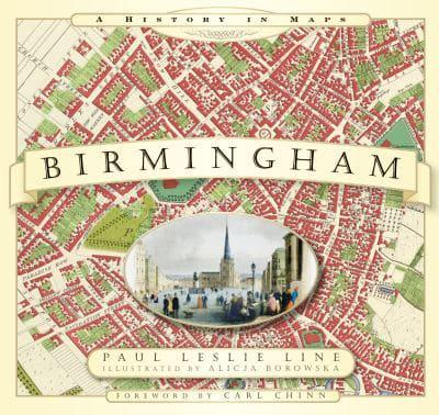
Publisher's Synopsis
From the exceptional town plans and maps contained within this unique volume emerges a social picture of Birmingham; a town quickly developing in size and population in the eighteenth century; along with the changes brought about by urbanisation. Land was bought up for development; hundreds of 'courts' were built to home the industrial workers pouring in from the many outlying villages. The many gardens, orchards and wide expanses of open space detailed on Wesley's 1731 plan of Birmingham were soon to be transformed into a sprawling mass of habitation. By 1765 Matthew Boulton, a leading entrepreneur and pioneer of the Industrial Revolution, had built his famous Soho Manufactory on Handsworth Heath. Shortly afterwards, the town plans of Birmingham in the first quarter of the 1800s chart the arrival of the railway; a plan from 1832 is the last glimpse of the city before the arrival of the Grand Junction Railway and other main line stations.
Accompanied with informative text and pictures of the cityscape, the many detailed plans contained in this historic atlas of Birmingham are a gateway to its past, allowing the reader and researcher to visually observe the journey of this historic town to city status in 1887 and beyond.