Philip's Road Map France and Belgium

Philip's Road Map France and Belgium - Philip's Sheet Maps

New edition

Paperback (03 May 2018)

Not available for sale

Includes delivery to the United States

Out of stock

This service is protected by reCAPTCHA and the Google Privacy Policy and Terms of Service apply.

Other formats/editions

Publisher's Synopsis

'THE CLEAREST AND MOST DETAILED MAPS OF EUROPE' David Williams MBE, CEO Gem Motoring Assist
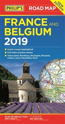
The map for navigating in France and Belgium:
- Main scale super-clear 1:1,00,000 (16 miles to 1 inch)
- Fully updated
- Scenic routes highlighted
- Maps on both sides - more for your money
- City plans: Bordeaux, Boulogne, Brussels, Calais, Lyons, Marseilles and Paris
- The important information for motoring: motorways (toll, pre-pay and free), mountain passes, railways, road numbers (European and local), distances between towns,
- Fully indexof place names
- Major city location maps
- All the places of interest for your trip: from castles, historic houses, beaches and national parks to theme parks, places of worship and ancient monuments
- includes Corsica

In fact, everything you need for your trip to France and Belgium

About the Publisher

Philip's

Philip's

Philip?s is one of Britain's best-known map, atlas and reference book publishers. It publishes many long established market leading titles across road and street atlases, as well as astronomy and reference. Philip?s is now leading the way with innovative new product for a rapidly evolving market.

Book information

ISBN: 9781849074377
Publisher: Octopus
Imprint: Philip's
Pub date:
Edition: New edition
DEWEY: 912.44
DEWEY edition: 23
Language: English
Weight: 104g
Height: 242mm
Width: 172mm
Spine width: 11mm