Publisher's Synopsis
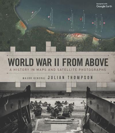
This volume provides a combination of Google Earth images showing the modern-day locations of crucial battles and strategic locations alongside specially commissioned maps showing troop movements, tactics, and topography.


Hardback (09 Jul 2020)
Not available for sale
Includes delivery to the United States
Out of stock
This volume provides a combination of Google Earth images showing the modern-day locations of crucial battles and strategic locations alongside specially commissioned maps showing troop movements, tactics, and topography.
| ISBN: | 9780233006123 |
| Publisher: | Headline Publishing Group |
| Imprint: | Welbeck |
| Pub date: | 09 Jul 2020 |
| DEWEY: | 940.530222 |
| DEWEY edition: | 23 |
| Language: | English |
| Number of pages: | 160 |
| Weight: | 800g |
| Height: | 224mm |
| Width: | 257mm |
| Spine width: | 21mm |