Motorways and Main Roads Map Northern Ireland

Motorways and Main Roads Map Northern Ireland

Revised edition

Sheet Map (folded) (04 Jan 2000)

Not available for sale

Includes delivery to the United States

Out of stock

This service is protected by reCAPTCHA and the Google Privacy Policy and Terms of Service apply.

Publisher's Synopsis

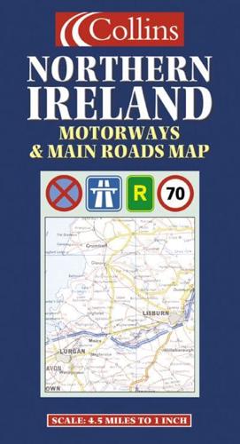
4.5 miles to 1 inch 1:288,000 Extremely clear full colour mapping, ideal for route planning.MAIN FEATURES• Extra large mapping at 4.5 miles to 1 inch• Exceptionally clean and clear mapping• Full index to place namesINCLUDES• Colour classified roads• Distances between towns• Railways and stationsAREA OF COVERAGECovers the whole of Northern Ireland plus Donegal and as far south as Dundalk.WHO THE PRODUCT IS AIMED ATThe clear, detailed mapping make this an ideal purchase for both residents and visitors.

About the Publisher

Collins

Collins

Collins has been publishing educational and informative books for almost 200 years. Throughout this rich heritage we have maintained an impressive record in creating market-leading products across various sectors.

Book information

ISBN: 9780004489759
Publisher: HarperCollins Publishers
Imprint: Collins
Pub date:
Edition: Revised edition
Language: English
Weight: 101g
Height: 250mm
Width: 135mm
Spine width: 5mm