

Publisher's Synopsis
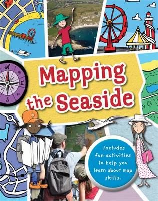
Full of hands-on activities to help you learn all about map skills whilst also learning about the features of the seaside. This book will show you what a bird's eye map is by looking at aerial photos of a seaside town;how tourist maps can help you find your way around; how symbols are used to represent landmarks, how to use a compass at the beach; how scale works by comparing two different harbours; to make a plan map of a pier showing how it is used; using grid references on a holiday campsite; planning a walk near a river estuary using a map; showing contour lines to map cliffs; using weather maps and landuse maps to show seaside buildings such as shops, hotels and houses; looking at islands and how teh water around them is mapped.
Illustrations by Sarah Horne in an amusing and lively style are combined with photographs to really capture a child's attention helping them to learn these important map skills.