Great Britain & Ireland - Michelin Rolled & Tubed Wall Map Encapsulated

Great Britain & Ireland - Michelin Rolled & Tubed Wall Map Encapsulated Wall Map

Sheet Map (rolled) (06 Apr 2004)

Not available for sale

Includes delivery to the United States

Publisher's Synopsis

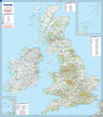
This Great Britain and Ireland wall map will give an overview of British and Irish cities, administrative boundaries, as well as primary and secondary road networks at a glance. This map is presented on a scale 1/1,000,000 and measures 100 x 88 cm. Our maps are regularly updated even if the ISBN does not change. (Edition updated in 2015)

Book information

ISBN: 9782067106529
Publisher: Michelin
Imprint: Michelin
Pub date:
Language: English
Number of pages: 1
Weight: 206g
Height: 100mm
Width: 60mm
Spine width: 60mm