Publisher's Synopsis
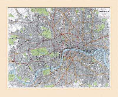
A very detailed street map of London first published a century ago as the expansive Victorian era finally drew to a close. The massive development of the nineteenth century is well illustrated by the appearance of numerous docks and factories along the lower reaches of the Thames where the constant bustle of trade served the needs of the Empire and the mother country. The railways serving other parts of the country were now well established and the underground train system competed with the trams for passengers within the capital. Large areas that were orchards, market gardens and marshes only fifty years before are now well within the built up area, but Willesden and Herne Hill are still shown as villages surrounded by open countryside. Each map is accompanied by an illustrated booklet which was produced to accompany the original edition and together they provide a fascinating glimpse into life in London a century ago. Rolled with a coloured 'mount' ready for framing.