


Publisher's Synopsis
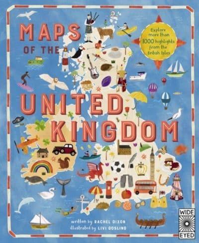
Take a tour of the United Kingdom as you've never seen it before in this fully illustrated set of county maps.
Travel through England, Northern Ireland, Scotland and Wales and meet the incredible people born there, learn about the UK's proud history and discover ancient castles, modern feats of engineering and natural highlights.
Revel in the nation's curiosities, from the spectacular, to the quirky, to the downright strange! Visit Edinburgh Castle with its spectacular views of Scotland's capital; see the home of Roald Dahl in Wales; and why not sample the local delicacies at Wigan's World Pie-Eating Championship?
With colourful maps packed with facts about every inch of this Sceptred Isle, from Land's End to John O'Groats, London to Londonderry, this book makes the perfect companion on long car journeys, summer holidays or rainy Sundays.
As well as acting as your go-to guide to things to see and do, Maps of the UK is also a beautiful atlas of the UK's history and culture, showing how Britons from all over the world have shaped the country for thousands of years.
A fabulous introduction to the UK's geography, history and culture, for readers young and old.